Spatial Institute Projects
Current Spatial Institute Projects
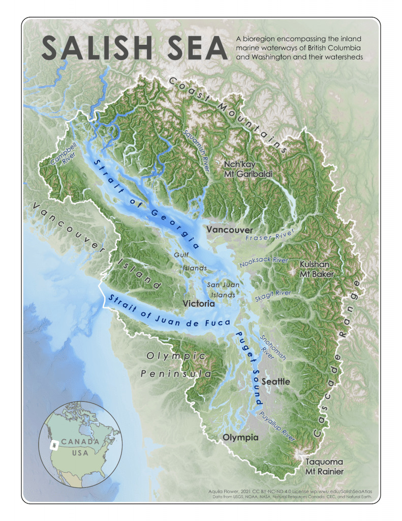
Salish Sea Atlas
The Salish Sea Atlas, authored by Dr. Aquila Flower, is an open access digital book containing maps, illustrations, interpretive text, and downloadable geospatial datasets addressing cultural and environmental themes across the Salish Sea Bioregion. This is a living atlas, with new content and updated datasets added as they become available.
The concept of a cohesive Salish Sea region has become a critical focal point for local education, research, restoration, conservation, and policy development.
Mapping Accessibility
The Mapping Accessibility Project (MAP) is a collaborative effort between Dr. Laso and dedicated undergraduate and graduate students. This project aims to create accessible maps, as they are crucial for disabled students to navigate and fully participate in campus life.
There is a direct link between the physical environment and social acceptance of groups of people with different body types; an environment that accommodates different needs translates to a greater likelihood that you will see a more diverse set of body types out and about.

WWU Spatial History
This map presents a spatial history of the main WWU campus, from 1894 to 2024 and was created by the Spatial Institute at the College of the Environment. Data collection for this project was primarily completed by students during winter quarter of 2024.
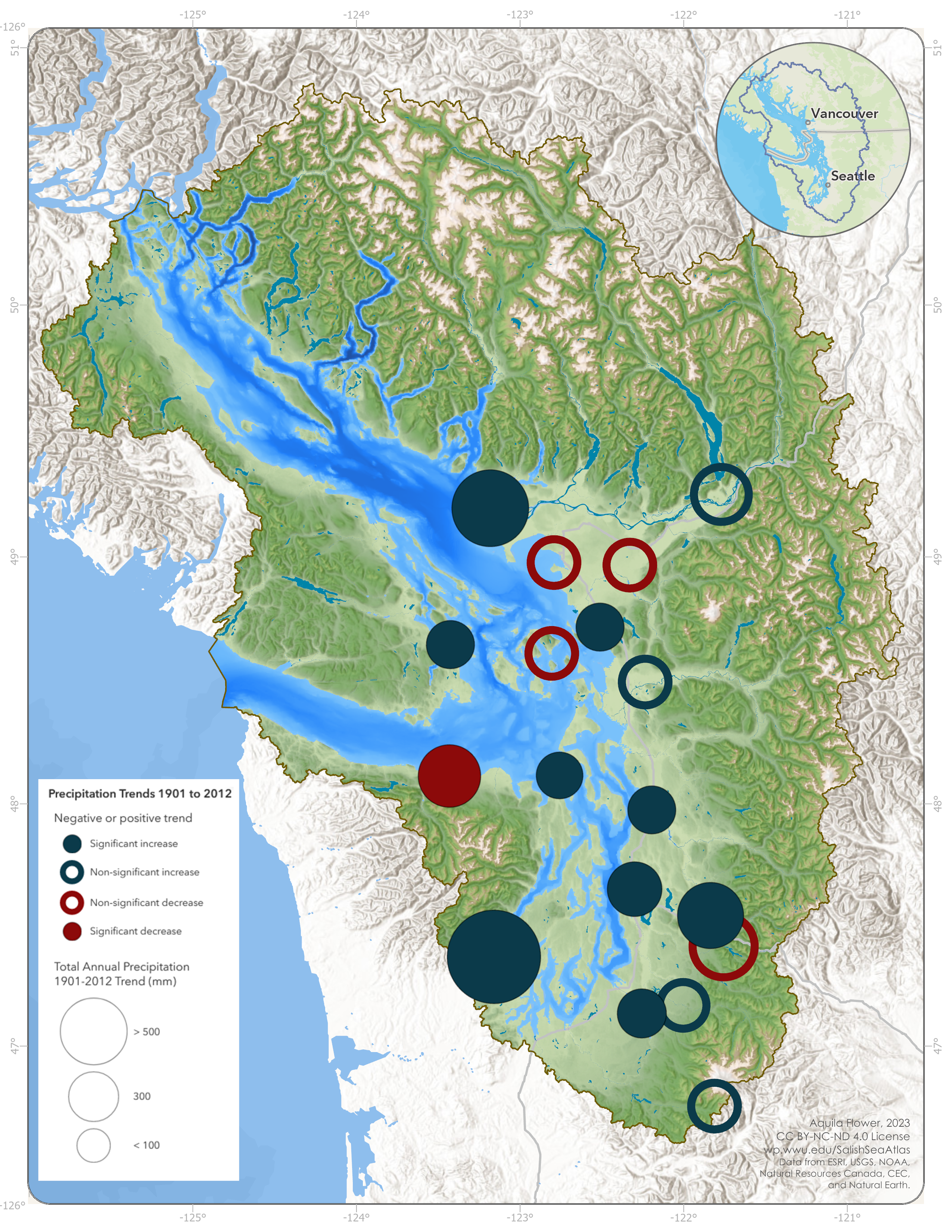
Climate Change Assessment for the Salish Sea
Climate change is one of the biggest threats facing the ecosystems, economies, and communities of the Salish Sea Bioregion. However, there is currently no easily accessible summary of past and future climate change specifically for the Salish Sea and its watersheds. To address this, Dr. Flower is working to complete the first Climate Change Assessment for the Salish Sea.
This will involve original analyses of historical climatic and hydrologic records and future climate projections from global and regional climate models. Final results will be released as a technical report, a website with interactive web maps to serve as a public education tool, and a curated suite of downloadable key climate variable spatial datasets for the Salish Sea Bioregion. This project has been supported by both the Spatial Institute and the Salish Sea Institute at WWU.