Introductions: Dr. Franciso Laso’s Galápagos research focuses on where “productive and protected areas meet”
The College of the Environment is excited to welcome Dr. Francisco Laso, Assistant Professor in the Environmental Studies department! Dr. Laso arrived at WWU as a visiting professor last year but now joins us full-time.
Since arriving at Western, he’s taught GIS (Geographic Information Systems), cartography, intro to research methods, and “Extractivism and its Alternatives in Latin America” in the Honors College.
Dr. Laso received a Ph.D. in Geography from the University of North Carolina at Chapel Hill in 2021, where his doctoral research delved into the interconnections between agriculture, wildlife -- where humans and their environment connect. “Humans need to feed themselves, and unsustainable farming practices have some of the most disruptive effects for the planet’s life-sustaining systems,” he says. “I am interested in collaborations between farmers and scientists to seek solutions situating humans as an integral part of their environment, not apart from it. The problems in food security and environmental conservation are linked, and so are their solutions.”
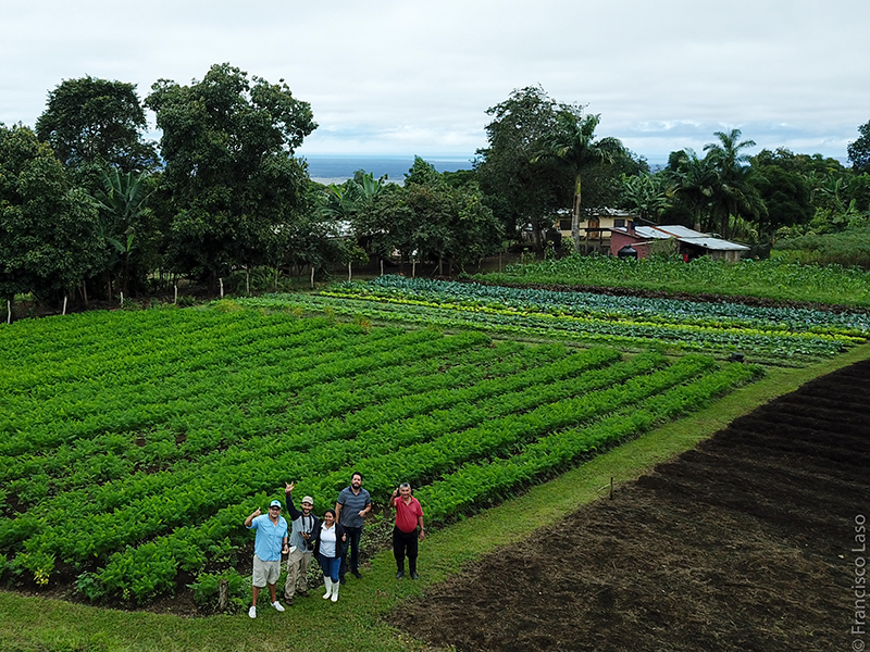
When you think of the Galápagos, you probably think of unique flora and fauna, but humans have inhabited the islands since the 1800s. Now, more than 33,000 people live in this archipelago off the coast of Ecuador. Centering on farmers’ role in conservation on the islands, Dr. Laso studied interactions between land use, invasive plants, and protected wildlife -- where humans and their environment connect. “Humans need to feed themselves, and unsustainable farming practices have some of the most disruptive effects for the planet’s life-sustaining systems,” he says. “I am interested in collaborations between farmers and scientists to seek solutions situating humans as an integral part of their environment, not apart from it. The problems in food security and environmental conservation are linked, and so are their solutions.”
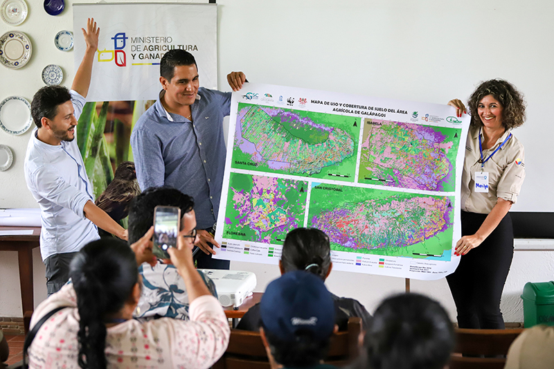
During his research, where he used various qualitative and quantitative methods and met with local farmers, he says, “I commonly heard farmers say, ‘Scientists come, ask us a lot of questions, and then leave. And we never know what happened with those results,’ so whenever I go to the field, I bring my previous results to show, printed and translated into a simple language.” This project led to the first high-resolution land cover map of agricultural areas in the Galápagos.
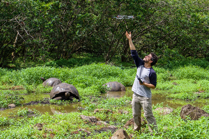
Because the inhabitants of the Galápagos all immigrated to the islands, there is a common belief that they do not have a unique culture. This past summer, Dr. Laso returned to the Galápagos to work alongside UPenn anthropologist Dr. Carter Hunt on a cultural inventory that will challenge this notion. While there, he also established an interdisciplinary network of scientists and farmers to help with long-term monitoring of agricultural areas that will be systematized and presented both academically and in ways that the farmers can benefit from. The group came upon a unique opportunity to initiate a study on Floreana Island, the first of the Galápagos to be inhabited and where today most residents make their living by farming. Conservation scientists are embarking on an ambitious project to eradicate introduced rat and feral cat populations and reintroduce tortoises on Floreana. Dr. Laso and the other scientists quickly stepped in to create a “before” picture ahead of the restoration work. They will return next year to monitor birds, reptiles, insects, and soil microorganisms and assess the impact on nearby agricultural areas.
Back at Western, Dr. Laso received a 2023 Diversity and Social Justice Grant for the project “Mapping Access and Disability at WWU.” He wanted to show students that maps can be powerful tools. “For my GIS classes, I had all these examples about how I was using maps in these faraway places like Galapagos,” he says. “But I wanted to show students that they could produce maps that can positively impact their immediate community, right here at WWU.” This project aims to engage with the disabled community in participatory mapping of the WWU college campus to visualize barriers, highlight areas without obstacles, and enhance the utility and accessibility of existing campus maps.
Stay tuned for updates on Dr. Laso’s research at https://cenv.wwu.edu/people/francisco-laso.